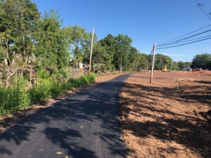
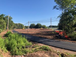
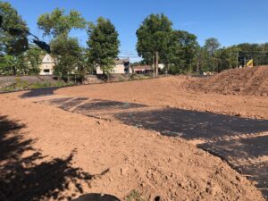
The Power Line Trail, up to now has only existed on paper, but recently a small section has come to life. As part of a new housing development under construction at the corner of Moyer Blvd and West Point Pike – just outside of West Point Village, a short section of the trail has been laid down.
 Hats off to the Upper Gwynedd Township municipal government, who ensured, as this development moved forward, space for the trail was set aside and ithe construction for this section was covered by the developers.
The Power Line Trail (Let’s all hope they come up with a more creative name) will eventually run on and off space beneath the PECO power lines. Generally one end will start where the power lines cross Morris Rd. near the 476 overpass. After it passes behind West Point Village, it will connect through the Parkside Place township complex, were it will overlap the planned Liberty Bell Trail along Sumneytown Pike and up Dickerson Rd. The trails then separate with the Liberty Bell Trail turning left onto Wissshickon Ave and then Pennbrook Parkway to connect to the back side of Stony Creek Park. The Power Line Trail will cross the SETPA tracks and connect up with the other side of Dickerson before turning right on Mill Rd and then crossing North Wales Road before wrapping behind Pennbrook Middle School and the Nor-Gwyn baseball fields and connecting over to Hancock Street. Eventually it should somehow link up with the 202 Parkway Trail which runs up to Doylestown.
 Earlier in 2023 Upper Gwynedd Township signed the lease agreement with PECO for access to the round beneath the power line across the length of the township. The funding for the trail segment along Mill Rd. to Hancock Rd., has been secured but construction has not yet started. Grants have been submitted for other segments, but even if those are awarded to the township, construction will not start before 2025.
The segment at Moyer and West Point Pike is short, but a significant sign of progress in building out the trails in the North Penn region. To ride on it, even for a brief moment can help local residents and elected officials begin to visualize what the completed trail network would feel like.
 If you do choose to come ride the trail segment here (it takes all of our 60 seconds to ride), it is suggested you do it after work hours in the evening or on weekends. Though the caution tape blocking the entrance is down, this is an active work area with large earth movers and backhoes still moving about during the day. Also – now and forever, please resist the temptation to checkout the rail line along the trail. It is an active railroad – mostly at night, but SEPTA (who owns the track) does occasionally, and unexpectedly bring service trains on this line in the day time.
Here is a link to a short ride video of the current trail segment.
Awesome 👏🏽
Looks great. What is a good parking & trail head location to access this? I don’t know the area.
Mike – this trail segment is literally about 200 yards long and takes about 1 minute to ride. There is no trail head, there is no parking. If you did want to check out by driving to the area, you could park up the street on Moyer Blvd. If you want something a little more interesting you could park next to the Upper Gwynedd Pool at Parkside Place and walk/ride the paved trail which leads out of the back of the park and is the start of the Green Ribbon Trail.
When you reach the endi of the pavement, instead of turning left and heading out the the Green Ribbon, go straight. You will cross a small bridge, then head slightly up hill until you reach West Point Pike. Here the paved trail ends, and so you take a left on the sidewalk.The next intersection, at the corner of Moyer Blvd and West Point Pike, you cross the street and you will then see the new paved Power Line Trail and the housing development under construction.